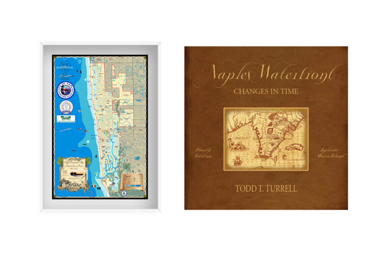
A Captain’s Guide to Naples: Maps and Books That Celebrate Our Coastline
If you’re someone who finds meaning in every tide, every shoreline detail, and every chapter of a city’s story—then the Naples collection at Island Map
If you’re someone who finds meaning in every tide, every shoreline detail, and every chapter of a city’s story—then the Naples collection at Island Map
If you’re someone who finds meaning in every tide, every shoreline detail, and every chapter of a city’s story—then the Naples collection at Island Map
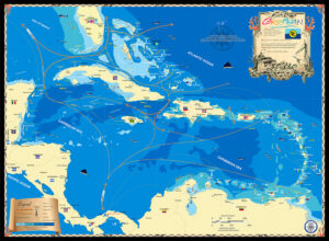
There’s a unique group of Islands in the southern Caribbean known as the ABC islands; Aruba, Bonaire and Curaçao. They’re featured in our detailed nautical
The ABC Islands are a group of three Caribbean islands located in the southern part of the Caribbean Sea, just north of the coast of
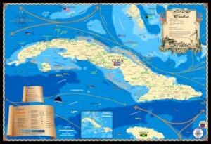
I’ve been lucky to have visited Cuba a number of times and traveled the coast visiting old towns and marinas that “once were”. My purpose
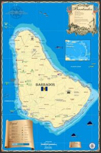
The Island Map Store’s Barbados map was made several years ago along with other islands in the lower Caribbean. When I pass through the area,
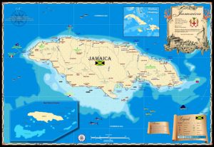
I’ve always enjoyed Jamaica since working there in the late 1980s and 90s. When Hurricane Gilbert mashed up the island in 1988 I went down
Island Map Publishing is a small company I started years ago since clients of our Marine & Environmental services company liked the maps we produced
There’s a unique group of Islands in the southern Caribbean known as the ABC islands; Aruba, Bonaire and Curaçao. They’re featured in our detailed nautical
The ABC Islands are a group of three Caribbean islands located in the southern part of the Caribbean Sea, just north of the coast of
I’ve been lucky to have visited Cuba a number of times and traveled the coast visiting old towns and marinas that “once were”. My purpose
The Island Map Store’s Barbados map was made several years ago along with other islands in the lower Caribbean. When I pass through the area,
I’ve always enjoyed Jamaica since working there in the late 1980s and 90s. When Hurricane Gilbert mashed up the island in 1988 I went down
Island Map Publishing is a small company I started years ago since clients of our Marine & Environmental services company liked the maps we produced