Maps
Mapping the Coast of the Continental United States
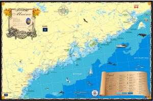
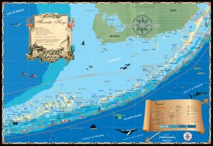
After nearly 20 years of making modern wall maps of the United States coastline, we’re proud to announce the completion of our collection covering the entire, contiguous,
After nearly 20 years of making modern wall maps of the United States coastline, we’re proud to announce the completion of our collection covering the entire, contiguous,
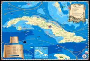
I’ve been lucky to have visited Cuba a number of times and traveled the coast visiting old towns and marinas that “once were”. My purpose
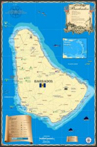
The Island Map Store’s Barbados map was made several years ago along with other islands in the lower Caribbean. When I pass through the area,
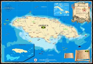
I’ve always enjoyed Jamaica since working there in the late 1980s and 90s. When Hurricane Gilbert mashed up the island in 1988 I went down
Island Map Publishing is a small company I started years ago since clients of our Marine & Environmental services company liked the maps we produced
Long Island has to be the “longest” true island on the eastern seaboard of the U.S. I’m from Florida, so here are some comparisons: Long
The Outer Banks is arguably the most famous string of barrier islands in the United States. The archipelago runs from south of the Chesapeake Bay
With every map we make at Island Map Publishing, I physically go to the area being drawn to meet with locals introduced through a network
I often give talks on history using antique maps as props. The maps are usually from my collection or from friends who are true map
Years ago I put an ad out for a partnership interest in my plane, a high performance Cessna 210 (6 passenger, 200 mph, retractable gear).